
")
7th June 2019
Google Maps to Show Hurricane Forecasts, Earthquake Strike Maps
[apss_share]
By PC Mag
Just in time for hurricane season, Google is rolling out new Maps features to help you stay informed about and steer clear of natural disasters.
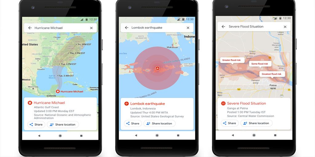
"In the days leading up to a hurricane, you'll see a crisis notification card on Google Maps that automatically appears if you're near the impacted area," Google Maps Product Manager Hannah Stulberg wrote in a blog post. "This card will direct you to a hurricane forecast cone, which shows the prediction of the storm's trajectory along with information about what time it's likely to hit certain areas, so you can use this information to plan how to react."
In addition to the new hurricane forecast cones, Maps will show earthquake information and flood forecasts. After an earthquake, you'll see a strike map in the app showing its epicenter, magnitude, and impact on surrounding areas.
"This information can help you quickly assess the reach of the earthquake and identify areas likely to have experienced the highest impact," Stulberg wrote.
In India, Maps will show flood forecast visualizations highlighting areas likely to be impacted and the expected severity there.
[apss_share]
")
