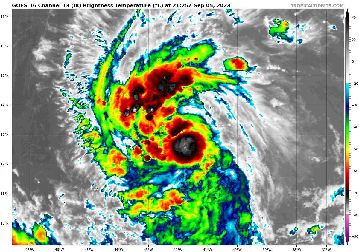
5th September 2023
Tropical Storm Lee forms between Africa and the Lesser Antilles and expects to become a extremely dangerous hurricane
By NHC


Tropical Storm Lee Advisory Number 2
NWS National Hurricane Center Miami FL AL132023
500 PM AST Tue Sep 05 2023
...TROPICAL STORM LEE EXPECTED TO RAPIDLY INTENSIFY INTO AN
EXTREMELY DANGEROUS HURRICANE BY THE WEEKEND...
SUMMARY OF 500 PM AST...2100 UTC...INFORMATION
----------------------------------------------
LOCATION...13.2N 41.8W
ABOUT 1315 MI...2115 KM E OF THE LESSER ANTILLES
MAXIMUM SUSTAINED WINDS...45 MPH...75 KM/H
PRESENT MOVEMENT...WNW OR 290 DEGREES AT 16 MPH...26 KM/H
MINIMUM CENTRAL PRESSURE...1005 MB...29.68 INCHES
WATCHES AND WARNINGS
--------------------
None.
Interests in the Leeward Islands should monitor the progress of
this system.
DISCUSSION AND OUTLOOK
----------------------
At 500 PM AST (2100 UTC), the center of Tropical Storm Lee was
located near latitude 13.2 North, longitude 41.8 West. Lee is moving
toward the west-northwest near 16 mph (26 km/h), and this motion is
expected to continue for the next few days with a slight reduction
in forward speed.
Maximum sustained winds have increased to near 45 mph (75 km/h)
with higher gusts. Lee is forecast to be a hurricane within a couple
of days and will likely become a major hurricane by Friday.
Tropical-storm-force winds extend outward up to 70 miles (110 km)
from the center.
The estimated minimum central pressure is 1005 mb (29.68 inches).
HAZARDS AFFECTING LAND
----------------------
None.
Key messages for Lee can be found in the Tropical Cyclone
Discussion under AWIPS header MIATCDAT3 and WMO header WTNT43 KNHC.
NEXT ADVISORY
-------------
Next complete advisory at 1100 PM AST.

TO RECEIVE NEWS NOTIFICATIONS VIA WHATS APP PLEASE SAVE OUR NUMBER AND SEND US A MESSAGE AT 7584896261 AND WE WILL ADD YOU TO OUR LIST


